Day 50-Ponferrada to Cacabelos

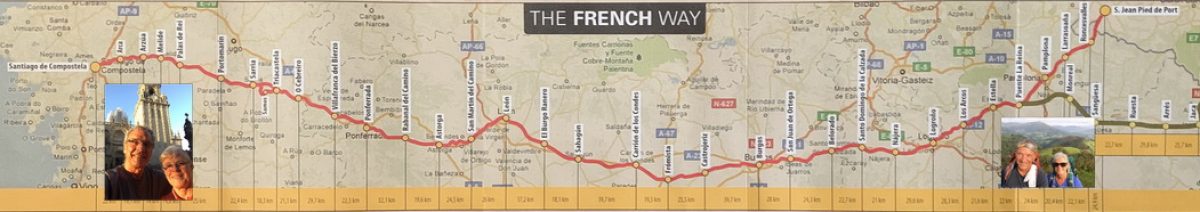
  • Distance Today                      9.0 mi
  • Distance Camino 2017     370.6 mi

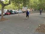
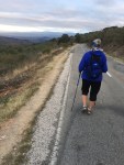
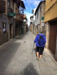
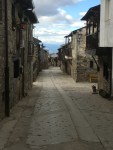
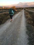
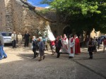
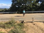
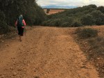
We spent most of the morning walking out of Ponferrada

and through several small residential communities, each promoting the wines of the Bierzo territory of Castile and León. Ponferrada is the current capital of the Comarca of Bierzo, while Villafranca del Bierzo was the historical capital. Cacabelos is between the two locations.

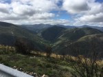
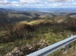
The territory of Bierzo is surrounded on all sides by mountains which makes the area very isolated. In pre-Roman times the region was populated by the Astures, a Hispano-Celtic Gallaecian people. They were conquered by Emperor Augustus in the Astur-Cantabrian Wars (29–19 BC) and the area quickly became the largest mining center of the Empire during the Roman period, where gold and other metals and minerals were extracted. Numerous Roman mining sites are still visible in the area as well as evidence of coal and other mining operations which dominated the economy up until the mid-20th century.

The Romans also imported grapevines, and wine production thrived in the region until the propagation of Phylloxera at the end of the 19th century, which destroyed the majority of the vineyards. The wine industry has since had a resurgence since the 1990’s and is now a major contributor to the economy as is tourism associated with the wine industry and the Camino Frances.

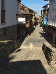
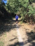
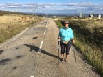
Today, the Camino took us through the older sections of Columbrianos, Fuentasnuevas, and Campanaraya.

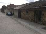
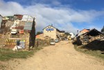
While there are still a number of very old, abandoned buildings, in very poor condition, there doesn’t seem to be an effort or apparent desire to raze them. We have observed this all along the Camino and in many other parts of Europe we have visited. Old buildings, especially homes, eventually get converted to something newer, usually preserving the outside, historical architecture. Instead of demolition, a “se vende” (for sale) sign is placed on the structure and eventually, we assume, a new owner will restore it or convert it to a different end use, as we have observed, rather than starting from scratch (which says a lot about the design and integrity of the original structure).

Another interesting observation today were the gardens. The homes along the road between the villages almost all had large gardens, beautifully maintained with evidence of bountiful crops even this late in the season. And on this Sunday morning several owners could be seen with hand implements, weeding and nurturing the items still growing.

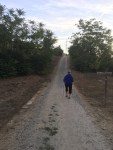
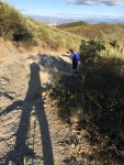
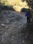
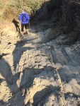
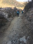
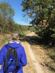
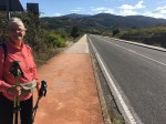
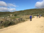
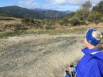
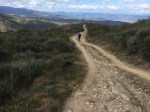
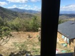
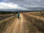
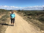
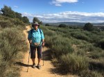
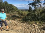
The final 4 miles of the walk took us back onto dirt paths through vineyards and other fruit and vegetable fields, in varying sizes.

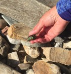
The grapes in this region have apparently been harvested as very few are visible on the vines and therefore inaccessible for pilgrim snacks.

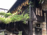
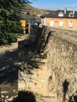
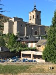
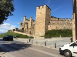
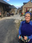
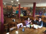
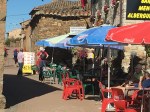
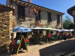
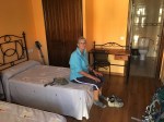
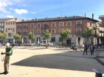
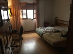
As we walked into Cacabelos, (pop.5475), on our right was Moncloa de San Lázaro (75€), our hotel, a converted 13th century pilgrim hospital. It only has 8 rooms and is apparently a destination itself, with a very popular restaurant featuring regional cuisine which was packed nearly all day, a large shop with local wines, art, crafts and sweets and a variety of facilities for groups.

While our room was being readied we were given a glass of the local Bierzo wine made from Mencía grapes, unique to the region, and a homemade empenada to occupy the 10 minute wait… an apparent tradition for Peregrinos.

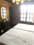
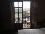
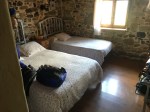
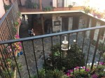
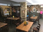
The hotel and our room is traditional and upscale in an understated way.

We both ordered the restaurant’s traditional 4 course lunch, which was very filling. It was nothing special and over-priced at 25€ per person.

After lunch (around 3:00) we returned to our room to rest from our walk, chill and swear off eating for the rest of the day.

Day 49-El Acebo to Ponferrada

  • Distance Today                      9.8 mi
  • Distance Camino 2017      361.6 mi

It was in the high 30’s when we began walking at 8:20.

The walk from El Acebo to Molinaseca included some very difficult paths dominated by protruding and loose shale. We were frequently slowed to a snails pace by truly terrifying treacherous terrain. Linda twisted an ankle in this area on our first Camino in 2015, so we were perhaps more cautious this time to prevent a Camino ending injury.

Whenever possible we walked on the parallel narrow asphalt road, but returned to the path when the road swung a significant distance away from the path.

From Molinaseca to Ponferrada we walked on sidewalks and a path that supposedly was a shortcut by 1.2 miles, but only took us into the city in a roundabout way with no saving in time or distance.

The weather was chilly but the sky was clear so we were rewarded with beautiful scenery for our efforts.

Ponferrada started off as a Celtic settlement, followed by a Roman mining town. The city was destroyed first by the Visigoths and then Muslim invaders. After the Reconquista, Bishop Osmundo of Astorga commissioned a pilgrim bridge here, which was unusually constructed with steel beams, giving the city its modern name. Ponferrada was a booming pilgrimage town, with diverse merchants including Franks and Jews, who were protected during a 15th-century restriction that called for segregating communities. The railroad came to the city in 1882 and in the 1940s the town grew with the coal industry.

The most impressive site is the  Templar castle built in the 13th century over a destroyed Visigoth fort, which was built over a Roman fort, which was built over a pre-Roman castro. Soon after its completion, the Templars were banished.

According to legend, the castle holds all kinds of secret Templar symbolism, such as the 12 towers representing the 12 months or the 12 disciples.

Iglesia de Santa María de la Encina on the Plaza Encinas, houses an image of Mary said to be originally in the Astorga cathedral, but it was hidden in the 9th century for protection from invading Muslims.

Years later, the image was miraculously found in an oak tree, hence the name “Our Lady of the Oak.” There is a statue in the plaza depicting the miracle.

We had a late lunch in our hotel, El Castillo, (55€) and pizza in a nearby plaza at 7:30 and called it a day.

Day 48- Foncebadón to El Acebo

  • Distance Today                      6.8 mi
  • Distance Camino 2017      351.8 mi

Today was all about scenery and a spiritually significant location on the pilgrimage of Camino Frances.

The taxi dropped us off at Foncebadón where we concluded our walk yesterday afternoon and we climbed the remaining 1.2 miles to the Cruz de Ferro, 4934 ft, the highest point on the Camino Frances.

Where the cross is now located is thought to have originally been an altar built to the Roman god Mercury, whereas some stories say that it is where the Celts worshiped, either way the origins were pagan. The cross is believed to have been placed here in the 11th century by Gaucelmo.

Traditionally pilgrims have left a rock here, whether picked up along their journey or brought all the way from their homeland. Some of the rocks that have been left here contain little messages to loved ones or the name of the pilgrim’s home town.

The tradition of pilgrims leaving a stone at the Cruz de Ferro was originally a very religious one and the purpose was to say a prayer at the Iron Cross and leaving the stone behind was very symbolic in that you were really leaving behind all your sins.


More recently, the tradition has been built on the recognition of leaving behind not only the sins that pilgrims carry but also other burdens in their life or the burdens of a loved one.

Linda placed a hand painted chestnut inscribed “Ed + Jo” for our friend Joselle, in memory of her beloved husband, Ed.

From the Cross, we walked another 5 miles, nearly every few steps an incredible new breathtaking view from the top of the world,

walking down Monte Irago, passing Manjarin 
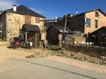
and continuing down a very steep, loose stone laden path into El Acebo (elevation 3770 ft).

El Acebo (pop.37) is a picturesque village typical of mountain villages of upper Bierzo with houses built from and covered in slate, the typical building material of the region. The slate laden paths add to the difficulty of the steep descent into the village. Another characteristic of the homes are the street-facing wooden balconies, that sometimes reach outside of an outdoor staircase. After finally breathing a a sigh of relief upon reaching the cobble stone street through the village, even it is built on a 30 degree slope.

We stopped at Hostel La Rosa del Agua (57€) and had lunch at 1:00pm until our room was ready.

Today has been chilly and windy beginning at 31 degrees in Foncebadón at 10:00 am and still a cool, windy sunny afternoon in the low 60’s, so we pretty much camped out in our room, washed clothes and rested from the morning hike,

took a brief walk and finished the day viewing a dramatic sunset.

Day 47- Santa Catalina de Somoza to Foncebadón

  • Distance today:                    10.2 mi
  • Distance Camino 2017:    345.0 mi

As we left Santa Catalina, it was a nice walking morning except for the 10mph wind in our face.

We stopped at Ganzo (pop.30) for breakfast and for Jim to put on a windbreaker and Linda a buff to cover her ears.

We continued on and the clouds got more ominous as we climbed deeper into the Cantabrigians Mountains, so we put on our pack covers and put our ponchos in outside, easy-to-reach pouches for the inevitable deluge. But thankfully, all we got was continuing winds and drizzle.


We reached Rabanal del Camino (pop.73) after climbing over 650 feet to an elevation of over 3800 ft.

The Hosteria El Refugio (50€) didn’t open until 11:30, so we had an early lunch at a nearby bar while we waited to check in.

We settled into our room and as we had hoped, the skies began to clear around 2:00 so we had a pilgrim lunch/dinner at 4:00 and then decided to walk to Foncebadón, another 3.5 miles up.

We originally wanted to stay tonight at Foncebadón but everything was booked so we opted to stay in Rabanal. This put us in the situation of having to walk nearly 11 miles tomorrow starting with the steep climb to Foncebadón, another steep climb to the Cruz de Ferro, the highest point on the Camino Frances, then another 5 miles down steep, rocky terrain to El Acebo.

We made our way to Foncebadón, by climbing another 800 ft to an elevation of 4600 ft, enjoying the beautiful views on the way up and at the top, allowed now by clear, blue skies. Once we got to the first albergue, at about 6:30pm, we called for a taxi and by 7:15, we were back in our room for the night in Rabanal del Camino.

We’ll sleep easier tonight knowing that we won’t have to tackle the walk to Foncebadón in the morning.

Day 46- Astorga to Santa Catalina de Somoza

  • Distance today:                      5.2 mi
  • Distance Camino 2017:    334.8 mi

What a wonderful day on the Camino!

At 7:40 it was light enough to walk without headlamps and long sleeves/long pants were very comfortable at 48F with no wind. The rising sun had the beautifully, clear blue sky all to itself.

Sidewalks through Astorga and the adjacent village of Valdeviejas, 
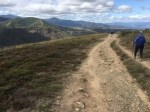
then a path alongside a lightly travel secondary road got us to Murias de Rechivaldo. 
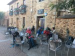
It was a really attractive village with a wide bricked walkway that led us to a strategically placed bar that was perfect for breakfast.

The next 3 miles were on a narrow, mostly straight dirt path surrounded by bushes and small trees, 
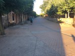
that gradually climbed 300+ feet in elevation before taking us into the village of Santa Catalina de Somoza (pop.60).

Our albergue, El Caminante (40€) is a real diamond in the rough in what some Camino guides call a ghost town. We really love this place.

Our habitacion doble con bano is immaculate, adequately spacious and on the second floor, overlooking a closed courtyard surrounded by dormitory rooms housing bunkbeds (litera) at 5€ each.

It has a separate area for washing clothes by hand or machine(3€) and hanging them out to dry with plenty of line and clothespins. Kinda like we died and went to heaven. (Thanks, Camino)

The bar/restaurant/albergue is beautifully decorated, the staff is very friendly, professional and service oriented. 
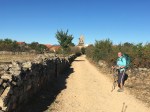
An abnormally wide range of tasty foods are available all day and the prices are very competitive.

Jim spent much of the afternoon sitting under an umbrella outside the albergue on “Calle Real”, working on the blog, greeting passing pilgrims, sipping a “cervesa grande” and occasionally coaxing an undecided pilgrim (be they German, Italian, Spanish. Australian, etc) to either stay for a meal or overnight.

Linda spent her afternoon exploring the small village, trying unsuccessfully to keep Jim out of mischief and stealing a few winks in our quiet, cool room.

At about 6:30, we took a nice walk around the village and viewed some of the great scenery around us, as we are on our way up to Foncebadón and nearby Cruz de Ferro, the highest point on the Camino. Our appetite built. We then returned to our albergue dining room and had a nice dinner including a bottle of the local wine, a fitting finish for another day on the Camino Frances.

Day 45- Villares de Órbigo to Astorga

  • Distance today:                        9.1 mi
  • Distance Camino 2017:     329.6 mi

Today we left the meseta and begin to walk among rolling hills with more green trees and even mountains came into view, previewing the nature of our challenges for the coming days.

After walking for 6 miles in our new terrain and just outside San Justo de la Vega, we stopped at the Crucero de Santo Toribio. 
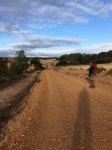
It is named for the 5th-century bishop of Astorga who was said to have fallen to his knees in despair at this spot, after being banished from his beloved city. We haven’t been able to determine why he was banished, but you’ll be the first to know if we find out. One clue is that he became a saint immediately after his death.

From the Crucero, we could see the spires of the Astorga Catedral.

We left the rolling hills and packed clay path and walked onto the sidewalks of San Justo and on into Astorga, after crossing the railroad tracks via another high, zig-zag pedestrian bridge.

The final climb up a very steep hill into Astorga old city was tough, especially at the end of a 9+ mile walk.

The Tuesday market completely jammed our walk from the Plaza San Francisco with a display of excavated Roman ruins

all the way to Plaza del Eduardo Castro.

The Gaudi Hotel (65€) was located directly across the plaza from Palacio de Gaudi and diagonally across from the 15th century Santa María Catedral.

The Palacio de Gaudí, was a palace for Archbishop Juan Bautista Grau Villespinós until his death. It sat empty until serving as a military headquarters for the Falange movement. In 1963, it became a Camino Museum.

The Santa María Catedral was impressive and imposingly huge in the relatively small space it occupied on the plaza. Later in the day when it was open for visitors we took a tour inside.

Astorga, (pop 12,078), first a Celtic settlement, developed into an important Roman city at the crossroads of the Via Trajana and the Vía de la Plata, as well as an important center for Christianity. According to legend, both St. James and St. Paul preached here. The bishopric of Astorga was one of the earliest Christian titles. The city passed to the Visigoths in the 5th century and was destroyed by the Muslims in 714, then reconquered by Ordoño I in the mid-9th century. After León was destroyed by Al-Mansur’s army, Astorga acted as the capital of the kingdom. The city flourished with the pilgrim trade and housed 21 pilgrim hospitals, the second most on the Camino Francés (after Burgos). One of these hosted Saint Francis of Assisi on his pilgrimage in 1214.